In an article published in the journal Nature on may25,2022, an archaeological team introduced how to use lidar to search for ancient civilization relics in a overgrown area in the Amazon region** It should be noted that this study is not about Ancient Aliens or long lost technologies, but aims to speculate on the local population level and residence size 1500 years ago.
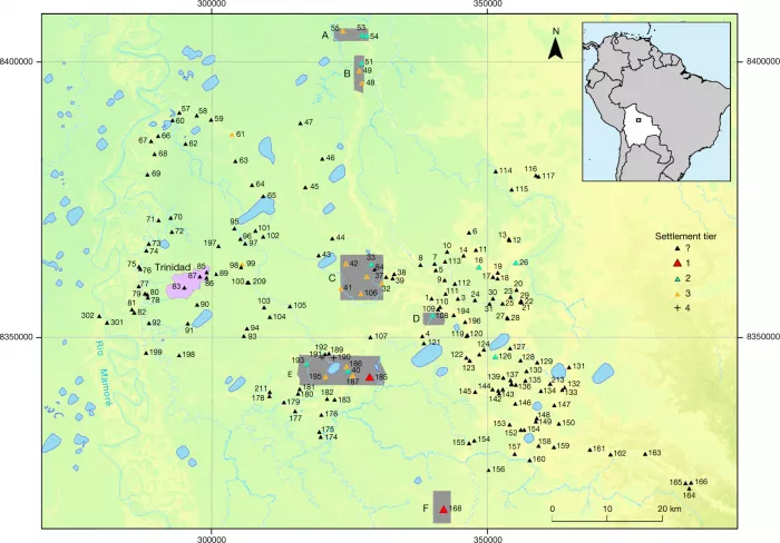
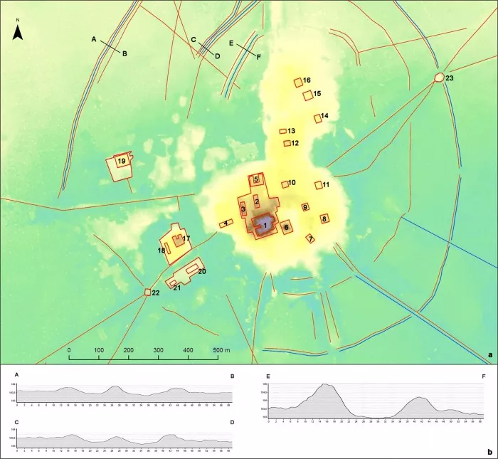
Study map - 1: Southeast map of Llanos de Mojos
Heiko PR ü mers of the German Institute of archaeology said in a nature Video: in the "pre Spanish" era, no one expected that there was such a dense social community in that area... The height of the pyramid reached 20 meters, which means that there is a new lost civilization waiting for us to study and explore.
Lost beneath the leaves Lasers reveal an ancient Amazonian civilisation(via)
It is reported that for a long time, the archaeological community had thought that before the arrival of Spanish and Portuguese explorers, there might be only a small tribal group in the Amazon region.
However, this typical "Eurocentrism" view is being challenged by more and more new scholars.
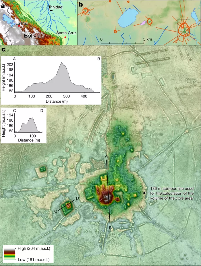
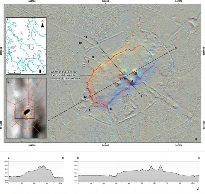
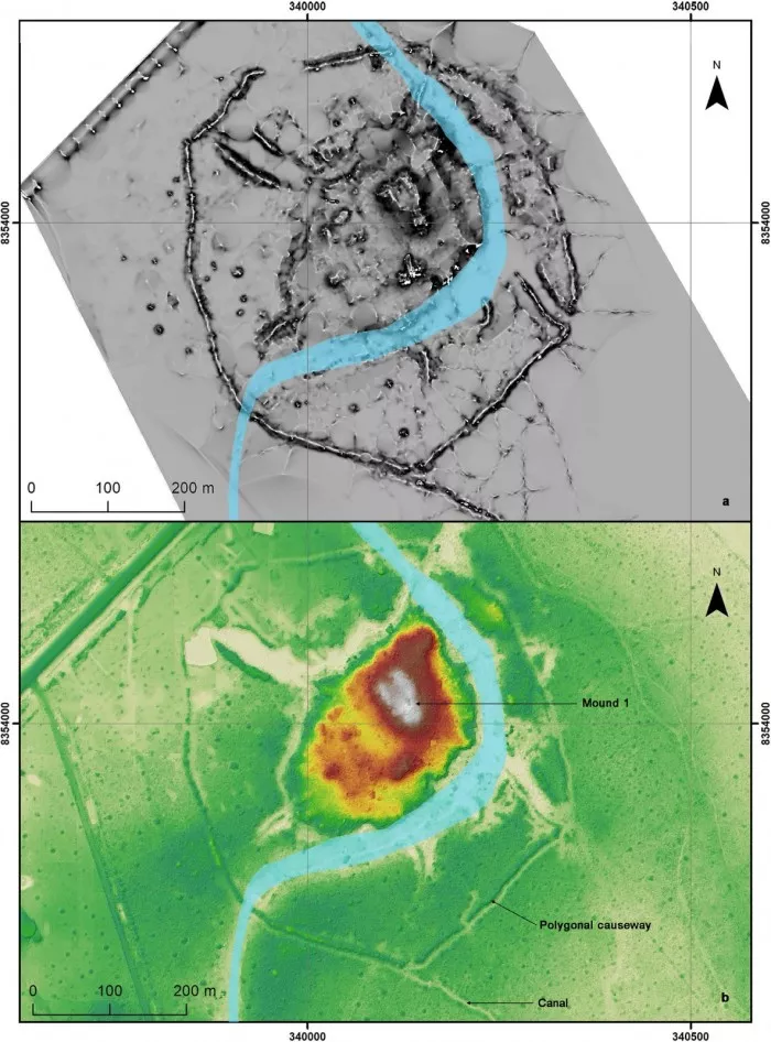
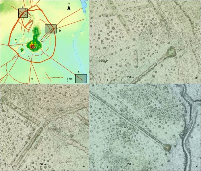
Study map - 2: site of cotoca 185
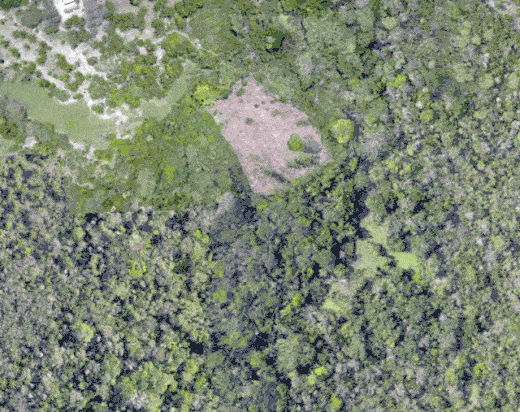
In this new study, Heiko PR ü mers took a keen interest in Lomas mound. Despite the long years of erosion, it has been covered by dense vegetation.
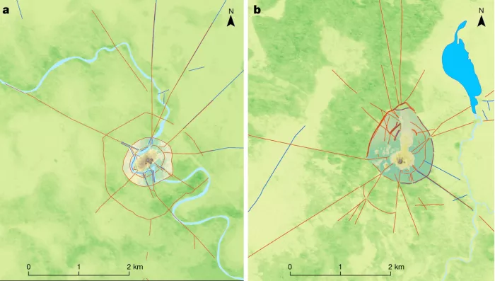
Study map - 3: map of two large settlements
However, the latest excavation research shows that this is not a so-called garbage dump, but an organized form of tombs and rituals, suggesting that there is a complex and hierarchical social composition behind the ancient civilization.
It is obviously not easy to find the protruding structure on the ground under the canopy of the rainforest. However, the research team cleverly used lidar devices mounted on helicopters to create the actual contour of the ground.
Extended Figure 1 - cotota site 185 / data map
Recently, this work has been proved to be effective - they have successfully found the entire Mayan city and even the one kilometer long artificial earthwork area.
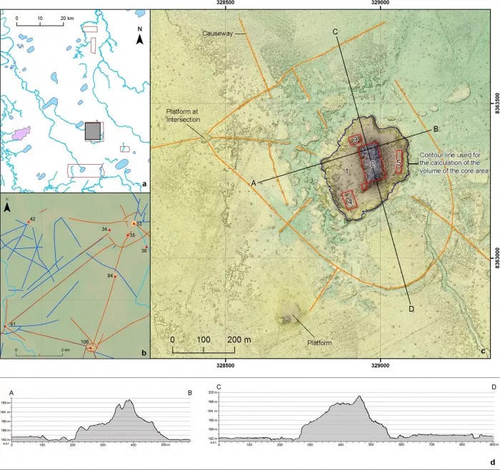
Extended Figure 2 - land í var site No. 168
The laser radar beam can pass through the branches and leaves and bounce back to the receiver, so that researchers can understand the height and structure of the ground under the hidden flag.
Extended Figure 3 - El Cerrito site No. 33
This technology can not only collect and analyze data faster than before, but also easily generate 3D point clouds that are easy to check hidden structures.
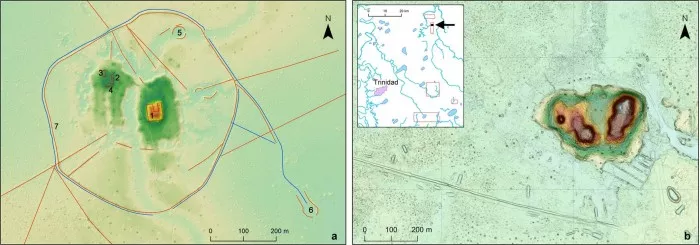
Extended Figure 4 - Santa Mar í a site No. 193 / San Nicol á s site No. 51
After analysis, it can be seen that the above-mentioned sites have large platforms, pyramids, fortifications, reservoirs, and even canals, and are connected with hundreds of settlements of different sizes.
Extended Figure 5 - map of Salvatierra site No. 108
This runs counter to the assumption that the local people belong to a nomadic / foraging culture rather than a settled / agricultural culture.
Extended Figure 6 - details of two U-shaped platform buildings
As for the casarabe Culture named after the excavation, it is still a mystery to a large extent. Even so, archaeologists have taken a very important step.
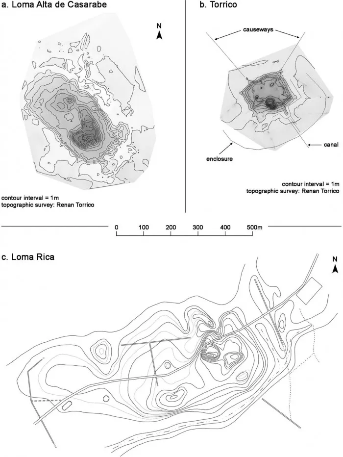
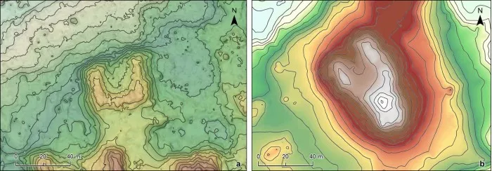
Extended Figure 7 - topographic map of three casarabe cultural sites previously surveyed
Heiko PR ü mers added: we need to wait patiently for further excavation of these sites to explain what we see now
Extended figure 8 - cotoca community (area E on Figure 1)
Considering the scale and duration of this work, PR ü mers, who has worked here for more than 20 years, still hopes that students can continue to make in-depth research in this area.
Extension Figure 9 - Causeway and polygon enclosure / junction platform / River opening / Southeast extension
Although according to PR ü mers' own estimation, it may take 400 years for future generations to excavate everything they found using lidar.
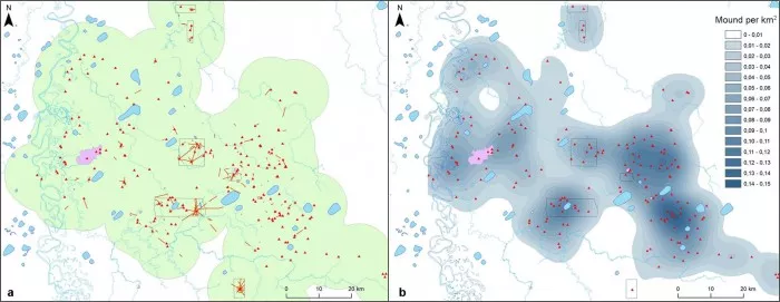
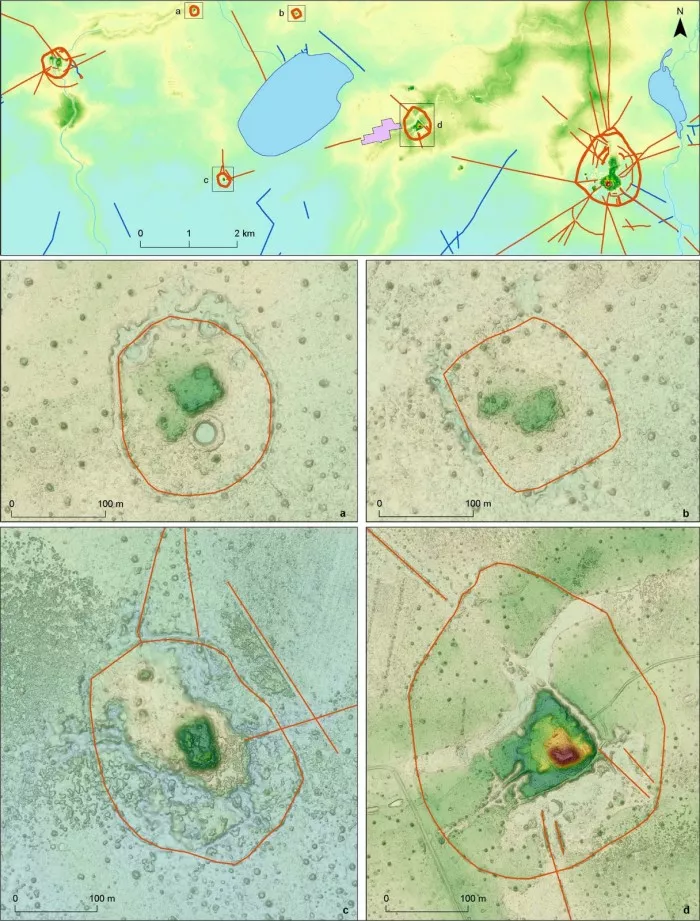
Expansion Figure 10 - ten kilometer buffer zone / site density map (higher concentration in the East)
Interested friends can move to nature To view the full text of lidar reviews pre Hispanic low density urban in the Bolivian Amazon.