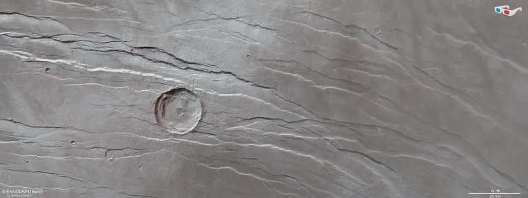
Recently, an image from the ESA Mars Express shows part of a large fault system on Mars called Tantalus fossae** This is a network of long grooves and scratches. At first glance, these features seem to be the result of fingernails or claws across the surface of the red planet, digging out long gullies in the process.
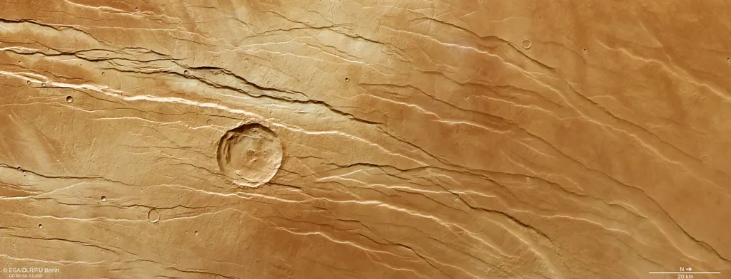
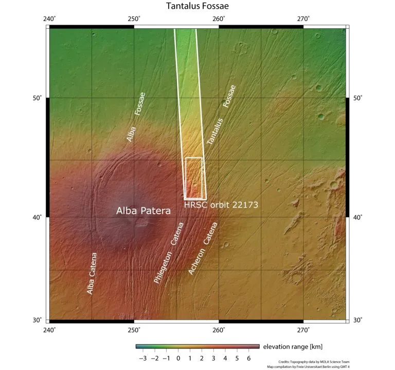
Although the formation process is not so dramatic, Tantalus fossae (fossae means cavity or depression) is an obvious feature on Mars. The trench system is located on both sides of a huge Martian volcano called Alba Mons, extending along the east side of the volcano.
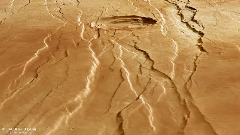
The trench is formed as the altitude of Alba Mons rises, causing the surrounding surface to become distorted, extended and broken. The Tantalus fossae fault is a good example of the surface features known as grabens; Each trench was formed when two parallel faults cracked, causing the rock in the middle to fall into the resulting void.
The same feature can be found on the west side of Alba Mons, forming an incomplete ring around the volcano. In general, the graben related to the volcano stretches for 1000 kilometers, 10 kilometers wide and 350 meters deep.
Complex history
These structures are thought to have formed not at the same time, but one by one, providing scientists with the opportunity to reconstruct the timeline of the past and create pictures of this dramatic landscape.
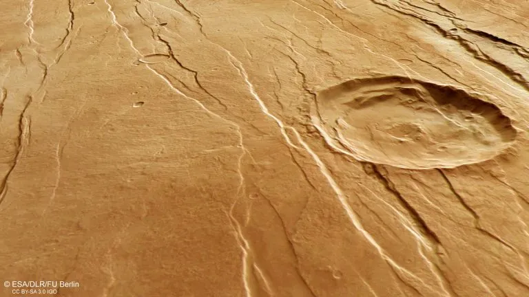
For example, the large impact crater in the center of the image is crosscut by a graben, indicating that it existed before the volcano was lifted to form the Tantalus fossae fault. The second largest impact crater (much smaller, at the lower left of the central crater) appears to overlap the fault and may therefore be younger.
Careful observation shows that many small, branched valleys can be seen in this area. These valleys seem to pass directly through grabens and are therefore considered older.
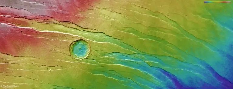
As the relevant topographic map shows, the terrain in the North (right) is much lower than that in the South (left) - in some places, the height is three kilometers lower. The researchers initially wanted to see any small, branched valleys running along the slopes of Alba Mons and merging at the lowest ground, but this was not seen here, which means that these valleys must have originated in older times.
Explore Mars
Since 2003, Mars Express has been running around the red planet, imaging the surface of Mars, mapping its minerals, determining the composition and circulation of its fragile atmosphere, exploring below its crust, and exploring how various phenomena interact in the Martian environment.
The mission's high-resolution stereo camera (HRSC) is responsible for capturing these new images, which reveal the diverse surface features of Mars. Recent images show features ranging from "brain" terrain and ridges and grooves to volcanoes, impact craters, tectonic faults, rivers and ancient lava pools.