During the historic heat wave in the Indian subcontinent, instruments on the space station recorded extreme temperatures in urban areas around Delhi Since mid March, a relentless heat wave has swept India and Pakistan, causing dozens of deaths, fires, increased air pollution and reduced crop production. The weather forecast shows that there is no prospect of mitigation in the short term. NASA's space station ecosystem thermal radiometer experimental instrument (ecostress) has been measuring these temperatures from space, with the highest spatial resolution of all satellite instruments.
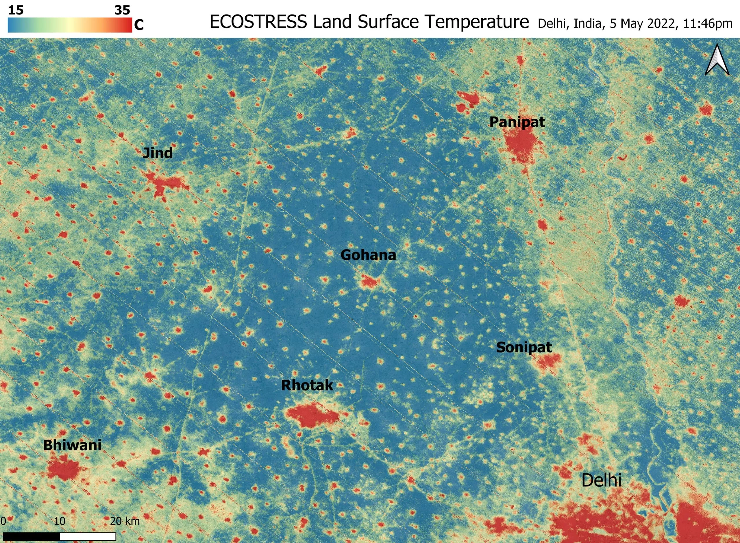
This ecostress surface temperature image, taken shortly before midnight on May 5, shows urban areas and agricultural land in Northwest Delhi (the big red area in the lower right corner), which has a population of about 28 million. The image covers about 4800 square miles (12350 square kilometers).
Due to the different materials and lifestyles used in human activities and building environment, the temperature in cities is usually significantly higher than that in surrounding villages. The image clearly delineates the "heat island" of these cities. The nighttime temperature in Delhi and several small villages is above 95 degrees Fahrenheit (35 degrees Celsius), with a maximum temperature of about 102 degrees Fahrenheit (39 degrees Celsius), while the nearby rural fields have cooled to about 60 degrees Fahrenheit (15 degrees Celsius). This data shows that the temperature experienced by urban residents is much higher than the average temperature recorded in their area.
Ecostress measures the temperature of the ground itself, which is very similar to the air temperature at night (although the ground may be warmer than the air during the day). The instrument was launched to the space station in 2018. Its main task is to determine the threshold of water use and water pressure of plants, and to have an in-depth understanding of their ability to adapt to a warming climate. However, ecostress can also be used to record other heat related phenomena, such as this heat wave.
The resolution of ecostress is about 225 feet (70 meters) × At 125 feet (38 meters), its high-resolution images become a powerful tool for understanding all aspects of weather events that may be ignored by traditional observation networks.
NASA's Jet Propulsion Laboratory (JPL) in Southern California builds and manages the ecostress mission for NASA's Geoscience Department at NASA headquarters in Washington. Ecostress is an earth risk perception instrument mission; The program is managed by the NASA Earth System Science Explorer program at the NASA Langley Research Center in Hampton, Virginia.