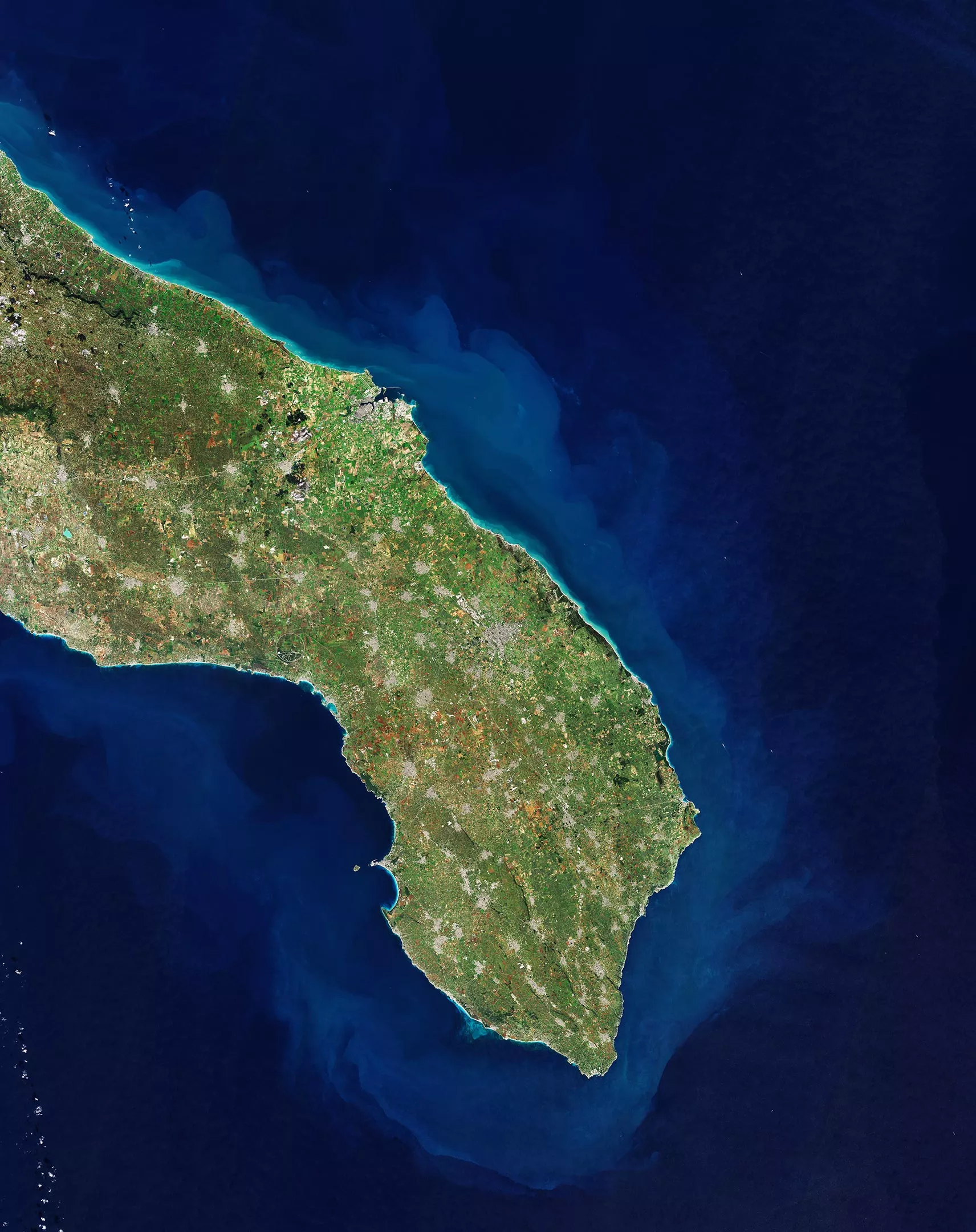
This image taken from space by the Copernicus sentinel 2 mission shows part of Puglia or Apulia in southern Italy. Puglia is an area of Italy, located in the peninsula area in the south of the country, bordering the Adriatic Sea in the East, the Ionian Sea in the southeast, and the Strait of Otranto and the Gulf of Taranto in the south.
Puglia has a population of about 4million. The largest cities in the region include Bari, Taranto, Foggia, Andrea, Lecce, baleta, Brindisi, artamura, mofeta and sereniola. It is famous for its long coastline, olive oil production and rich archaeology.
Puglia, the heel of this boot like country, has the longest coastline of all parts of mainland Italy. Covering an area of nearly 20000 square kilometers (7500 square miles), it is the seventh largest region in Italy. Its coastline is dotted with some of Italy's best beaches and blue sea, stretching about 800 kilometers (500 miles). Puglia has a population of about 4million, bordering the Adriatic Sea in the East and the Ionian Sea in the West.
Puglia is the least mountainous area in Italy, which is composed of wide plains and low hills. It is the location of two national parks, namely altamurja National Park and Gargano National Park. This region is one of the largest and most productive plains in Italy, where a large amount of wine and olive oil are produced.
The main town of Puglia is Bari (not seen in the picture), which is the largest city and metropolitan area on the Adriatic Sea. The major cities in the picture include Brindisi, which can be easily identified as a major port city along the Adriatic Sea, and Lecce, a city across the Adriatic Sea and the Ionian coast. Lecce has a large historical center, including the famous cathedral square and many 16th century Baroque buildings, including St. Croce cathedral.
Another historic coastal city and port is Otranto, about 40 kilometers (25 miles) from Lecce, visible in the Adriatic Sea. On a sunny day, Albania can be seen on the Strait of Otranto.
The coastal town of Gallipoli can be seen on the Ionian coast, at the bottom of the picture. The old town center is located on a small island, connected to the mainland by a 17th century bridge.
In addition to providing detailed information about the earth's vegetation, sentinel Copernicus 2 was designed to play a key role in mapping differences in land cover to understand the landscape, map its use, and monitor changes over time.
This picture was taken on January 19, 2022 and also appeared in the ESA video program "seeing the earth from space".