According to CNET, storms, volcanic eruptions, wildfires, clouds NOAA's new goes-18 satellite will witness all this and help people better predict and understand weather, climate issues and natural disasters NASA launched the satellite on March 1. Originally known as goes-t, it is now sending back an eye opening view of the earth
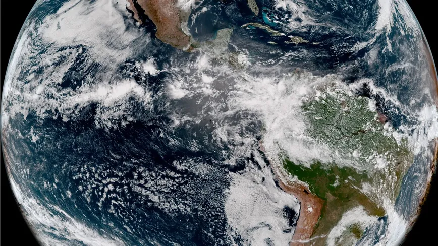
NOAA shared the first image of the satellite on Wednesday. A video shows wonderful photos of the earth and scenes of storms, dust and wildfires.
Goes-18 is a geostationary satellite, so it maintains an orbit of 22236 miles (35800 kilometers) above the equator, enabling it to continuously observe the Western Hemisphere and track the same area of the earth at any time. "We get 30 times more data on this satellite than on previous satellites," said alreen Knaub, deputy project manager of goes-t. "We are studying space weather, solar weather and earth weather."
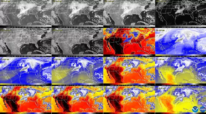
New images show that the satellite is operating as expected. NOAA in a statement "Goes-18 is currently conducting post launch testing, verification and calibration of its instruments and systems in order to prepare for its operation. If all goes well, the satellite will get a new name, goes West, in early 2023, because it will replace the existing goes-17 satellite facing technical challenges," it said
Goes-18 will become an important tool for weather forecasting and tracking the following storms and disasters.