Many researchers believe that liquid water is the key to understanding the behavior of frozen forms found in glaciers. It is well known that melted water can lubricate their gravel base and accelerate their journey to the sea. In recent years, scientists in Antarctica have discovered hundreds of interconnected liquid lakes and rivers, which are located in the ice. Moreover, they also photographed a thick sediment basin under the ice, which may contain all the largest reservoirs. But so far, no one has confirmed the existence of a large amount of liquid water in subglacial sediments, and no one has investigated its possible interaction with ice. Now, for the first time, a research team has mapped a huge, actively circulating groundwater system in deep sediments in western Antarctica**
They say such systems may be common in Antarctica and may have hitherto unknown effects on how the frozen continent responds to climate change and may even contribute to climate change. The study was published in [Science] on May 5( https://www.science.org/doi/10.1126/science.abm3301 ) 》In the magazine.
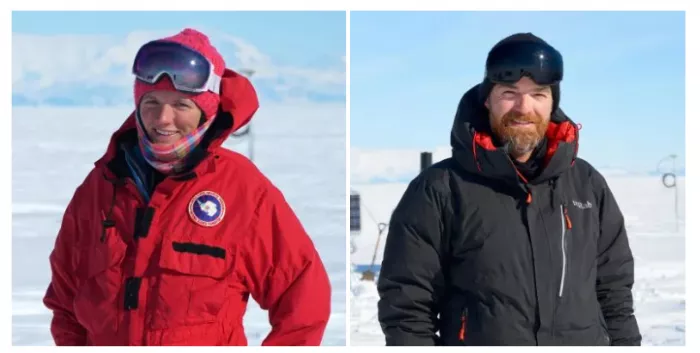
"People have assumed that there may be deep groundwater in these sediments, but so far, no one has done any detailed imaging," said Chloe Gustafson, the study's lead author, who did the study as a graduate student at Columbia University's Lamont Doherty Earth Observatory. "The amount of groundwater we found is so large that it may have affected the glacier process. Now we have to find out more and find out how to incorporate it into the model."
Scientists have been imaging the Antarctic ice sheet underground and other instruments for decades. In many other ways, these tasks reveal sedimentary basins sandwiched between ice and bedrock. However, airborne geophysics can only reveal the general outline of these characteristics, not water content or other characteristics. In one exception, the 2019 study of the McMurdo Dry Valley in Antarctica recorded groundwater under glaciers hundreds of meters below about 350 meters of ice using instruments carried by helicopters. But most of Antarctica's known sedimentary basins are much deeper, and most of its ice is much thicker than airborne instruments can reach. In a few places, researchers have drilled through the ice into the sediment, but only the first few meters. Therefore, the model of ice behavior only includes the hydrological system within or under the ice.
This is a big defect; Most of the vast sedimentary basins in Antarctica are located below the current sea level, sandwiched between the bedrock covered land ice and the marine ice shelf floating on the continental margin. They are thought to have formed on the seafloor during warm periods when sea levels were high. If the ice shelf is pulled back in the event of climate warming, the sea water may re invade the sediments, and the glaciers behind the ice shelf may rush forward, raising sea levels around the world.
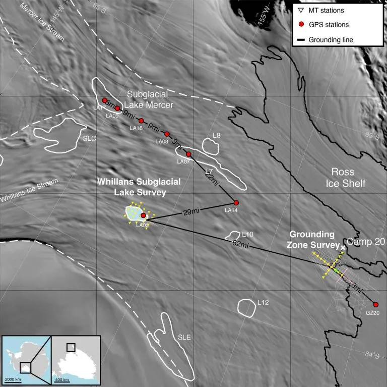
The researchers for the new study focused on the 60 mile wide Whelan ice Creek, one of several fast-moving streams that provide water to the world's largest Ross Ice Shelf, about the Yukon area of Canada. Previous studies have found that there is a lake under the glacier in the ice and a sedimentary basin below it. Shallow drilling of the first foot or so of sediment revealed liquid water and a thriving microbial community. But what's next has always been a mystery.
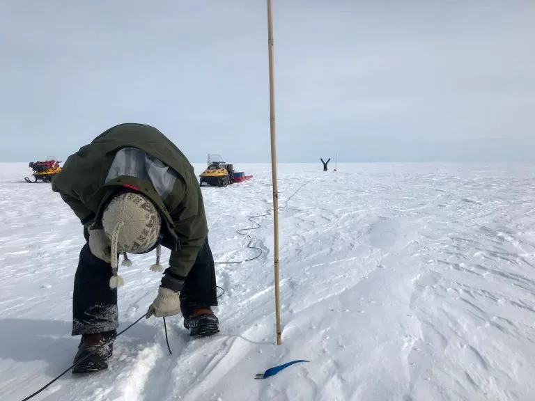
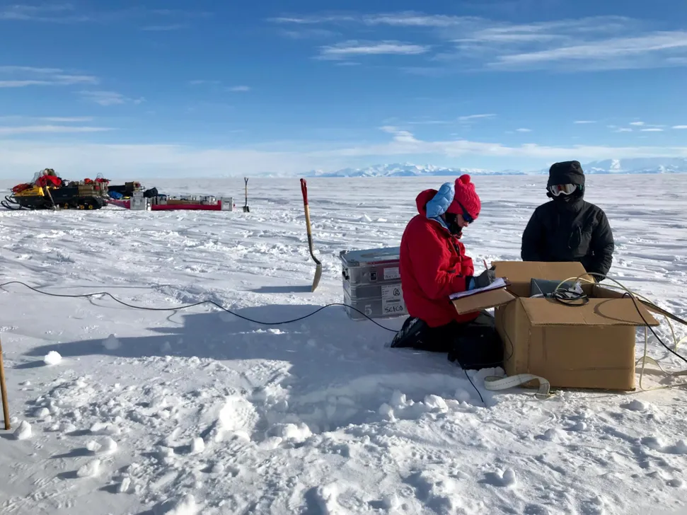
The team uses a technology called electromagnetic energy penetration in the earth's atmosphere, which produces electrical energy in the earth's atmosphere. Ice, sediment, fresh water, salt water and bedrock all upload conductive magnetic energy to varying degrees; By measuring the differences, researchers can create NMR like maps of different elements. The team placed their instruments in snow pits for about a day at a time, dug them out and repositioned them, and finally took readings at about 40 locations. They also reanalyzed natural seismic waves from the earth, which were collected by another team to help distinguish bedrock, sediment and ice.
Their analysis shows that, depending on the location, the sediment extends half a kilometer to nearly two kilometers to the bottom of the ice before touching the bedrock. And they confirmed that the sediments were filled with liquid water all the way down. The researchers estimate that if all the water is extracted, it will form a water column from 220 meters to 820 meters high, at least 10 times more than the shallow hydrological system inside and at the bottom of the ice, or even more.
Salt water conducts energy better than fresh water, so they can also show that groundwater becomes more salty with depth. Researcher Kerry key says this makes sense because these sediments are thought to have formed in the marine environment a long time ago. Ocean water may have reached the area now covered by Whelan for the last time in a warm period about 5000 to 7000 years ago, saturating the salt water in the sediments. When the ice layer moves again, the fresh melt water generated by the pressure above and the friction at the bottom of the ice is obviously forced into the upper sediment. Key said that today it may continue to filter down and mix in.
The researchers say this slow discharge of fresh water into sediments can prevent water from accumulating at the bottom of the ice. This may act as a brake on the forward movement of the ice. Measurements made by other scientists at the ground line of the ice stream, where the ice stream on land meets the floating ice shelf, show that the water there is less salty than normal seawater. This indicates that fresh water is flowing to the ocean through sediment flow, making room for more melt water to enter and maintaining system stability.

However, if the ice is too thin - an obvious possibility as the climate warms - the direction of water flow may be reversed, the researchers said. The pressure in the upper layer will decrease and deeper groundwater may begin to gush out to the ice base. This further lubricates the bottom of the ice and increases its forward movement. In addition, if the deep groundwater flows upward, it can carry the geothermal energy naturally generated in the bedrock; This can further thaw the bottom of the ice and push it forward. However, it is unclear whether this will happen and to what extent.
"Ultimately, we don't have a big limit on the permeability of sediments or the speed of water flow. Will it make a big difference and lead to runaway reactions? Or is groundwater a smaller role in the big plan of ice flow?" Gustafson said
The presence of known microorganisms in shallow sediments adds another problem, the researchers said. This basin and other basins are likely to be suitable for habitation further away; If groundwater begins to move upward, it will bring dissolved carbon used by these organisms. Horizontal groundwater flow will send this carbon to the ocean. This could turn Antarctica into a hitherto unrecognized carbon source. But the question is whether it will have some significant impact, Gustafson said.
The researchers say the new study is only the beginning of solving these problems. "The confirmation of the existence of deep groundwater dynamics has changed our understanding of glacier behavior and will force the revision of glacier groundwater models," they wrote
Other authors of the study were Helen Fricker of the Scripps Institute of Oceanography, J. Paul WinBerry of the University of central Washington, Ryan Venturelli of Tulane University and Alexander Michaud of the Bigelow marine science laboratory. Chloe Gustafson is now a postdoctoral researcher at the Scripps Institute of Oceanography.