Recently, Google will launch two major updates to celebrate the 15th anniversary of the launch of Google map service The first is a new feature of its IOS and Android applications - historical street view images will be displayed on users' mobile phones. The second is a new and more portable camera, which Google hopes will make it easier to capture street view images in the future.
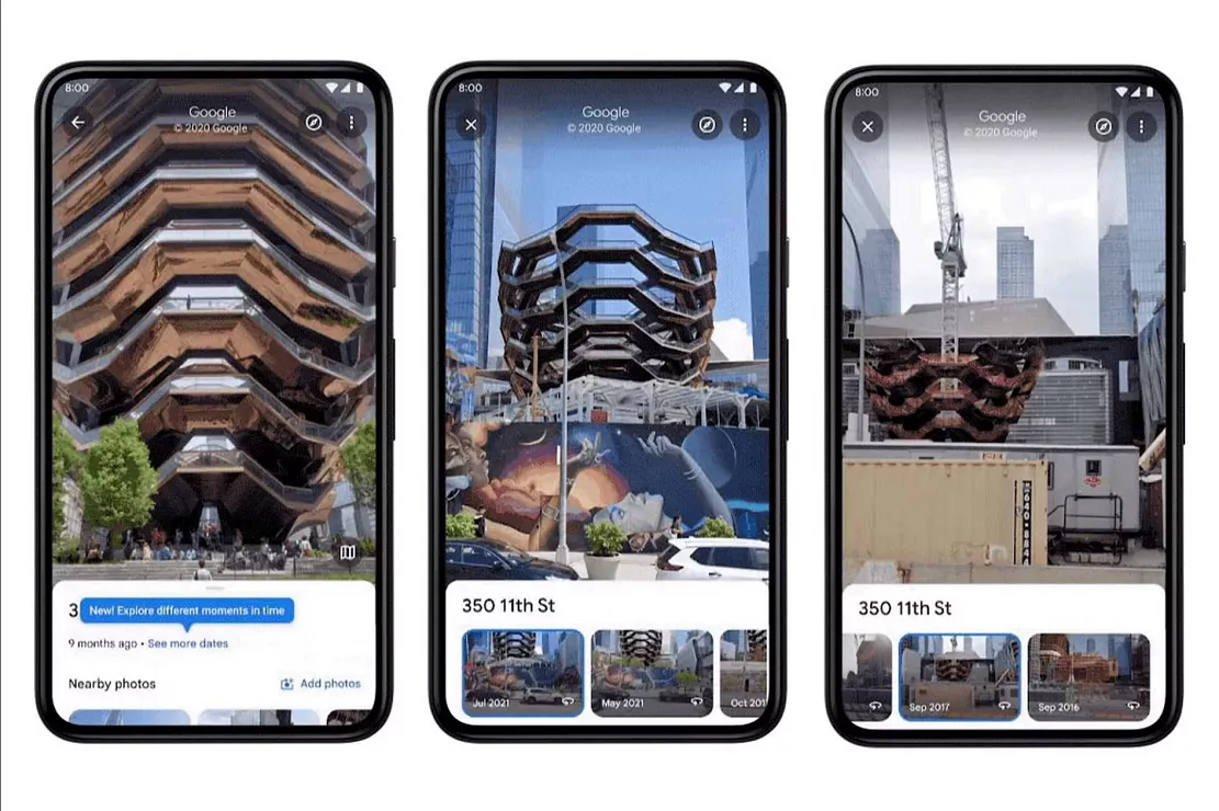
Since 2014, people can use street view maps through the desktop version of Google maps to understand the changes of a place over the years. But now, the service's IOS and Android applications will have the same capabilities. In street view mode, users can access it by clicking anywhere on the screen, and then select "view more dates" to access the historical image of a location. Google advertises that the feature will display images dating back to the launch of street view in 2007.
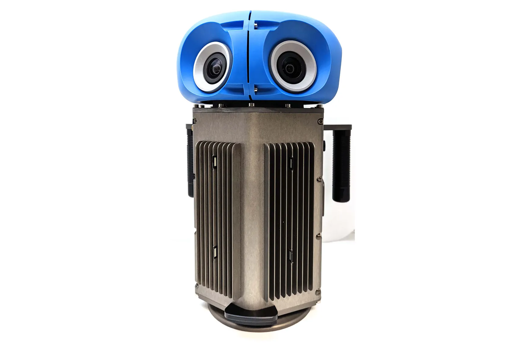
To coincide with the anniversary of street view, the second news released by Google is a new and more portable camera for capturing 360 degree images. At present, the search giant uses special cars and large backpacks equipped with cameras (called Trekker) to photograph the world, but the new camera reduces all these functions to a device weighing less than 15 pounds, which, in Google's own words, "is about the size of a domestic cat".
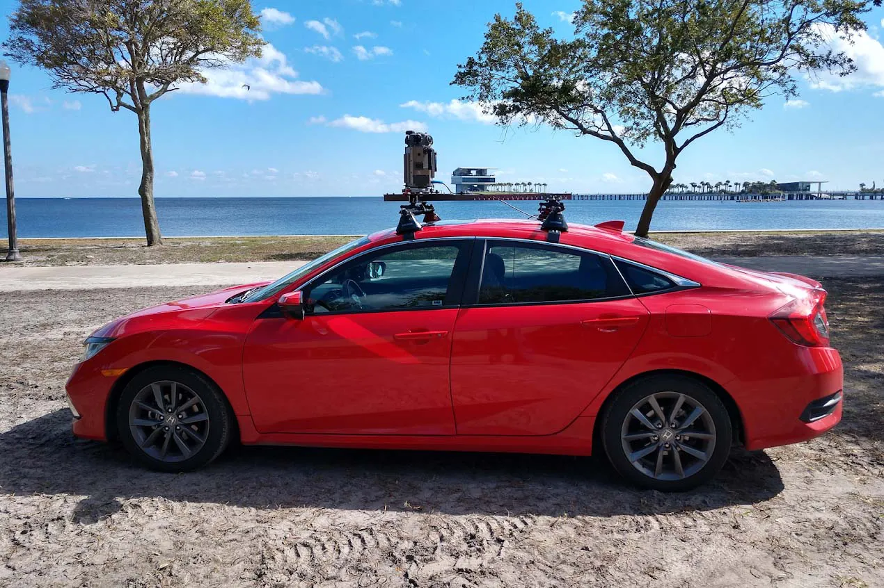
Google designed the camera to make it easier for it to capture street view images around the world and update them more frequently. Considering that street view data has been collected by tying existing bulky cameras to various vehicles from snowmobiles to gondola in Venice, it is easy to imagine that Google should be able to tie new cameras to various new vehicles.
In addition to Google's emphasis on the portability of the new camera, Steven Silverman, head of the street view hardware team, also pointed out that the appearance of each panorama should have some advantages. "The quality of sensors is higher and their signal-to-noise ratio is lower. These images will be more beautiful." It is understood that the resolution of the panorama captured by seven camera sensors in each camera is 140 million pixels, which is the same as before. Although there is no built-in lidar sensor by default, Silverman said that the design of the camera can be customized, that is, they can be added when needed in the future.
Street view is a really useful feature and an interesting new thing. For Google, letting the camera roam the streets is also a useful way to improve Google's map data. Street view images are used to add new businesses, improve business hours and provide speed limit information on roads on Google maps.
It will be launched next year with Silverman's new camera.