Google Maps now helps you breathe fresh air In this update, Google maps will remind you of the air level around you, so that you can make more informed decisions when to travel and how long to stay outdoors
Access:
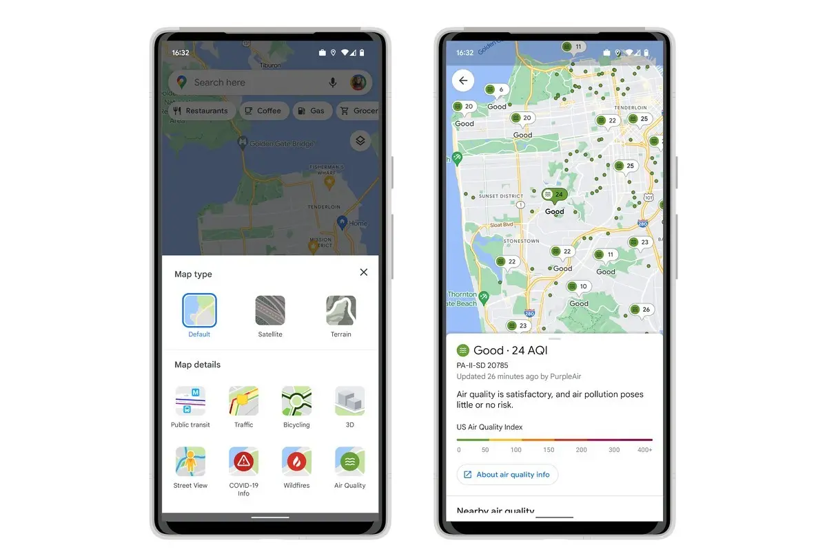
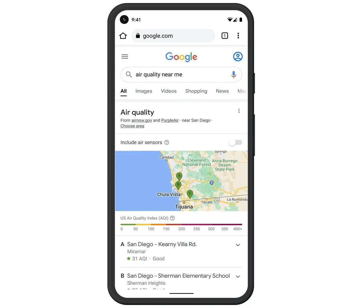
You will see AQI or air quality index figures, as well as outdoor activities guidance, the last update time of information, and links to learn more. These data come from trusted government agencies, including the US Environmental Protection Agency (EPA). The map also shows the air quality information from purpleair, a low-cost sensor network that can give you ultra local conditions.
To add this air quality layer to your map, you need to click the button in the upper right corner of the mobile screen, and then select air quality under map details. Purpleair information can also be used on nest monitors and speakers.