The "perseverance" continued to enter the hawksbill gap and made remote sensing observations on a small part of the exposed rock strata to find a good place to collect samples. As the "perseverance" is located in the square open space of Shenandoah, the members of the scientific research project team use the target name of Shenandoah National Park.
It is reported that the names used in the past week include ball_ Face_ Mountain、Little_ Devil_ Stairs、Sunset_ Hill、Luck_ Hollow and moody_ Creek。 "Perseverance" recorded the progress of nearly 400 meters in the week from May 15 to 21. As of the 446th sun day, the total distance since landing has exceeded 11.8 kilometers.
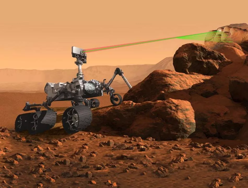
In another first, perseverance selected two targets on the 442nd solar day and photographed them with a supercam laser to determine their elemental composition. It is worth noting that the target is the rover itself rather than the operation team. Usually, when the rover team selects the target, it will not observe until the next day. If perseverance chooses its own target, it can shoot immediately after driving. Many hours before the returning Rover team has time to receive and analyze navcam images from the rover's new location and select the target.
Obtaining the results of supercam immediately can remind the team of the unusual composition so that a decision can be made for further analysis before the rover continues. The software package selected to achieve this goal is called autonomous exploration for gathering increased Science (aegis), which was developed by JPL for the previous roaming task and is applicable to the supercam of "perseverance".
Aegis requires navcam images to be taken, and then it will analyze the images to find rocks. In addition, it can give priority to analyze them according to size, brightness and other characteristics. It then initiates a sequence in which supercam emits its laser to determine the chemical composition of one or two of the top priority targets selected from the navcam image.
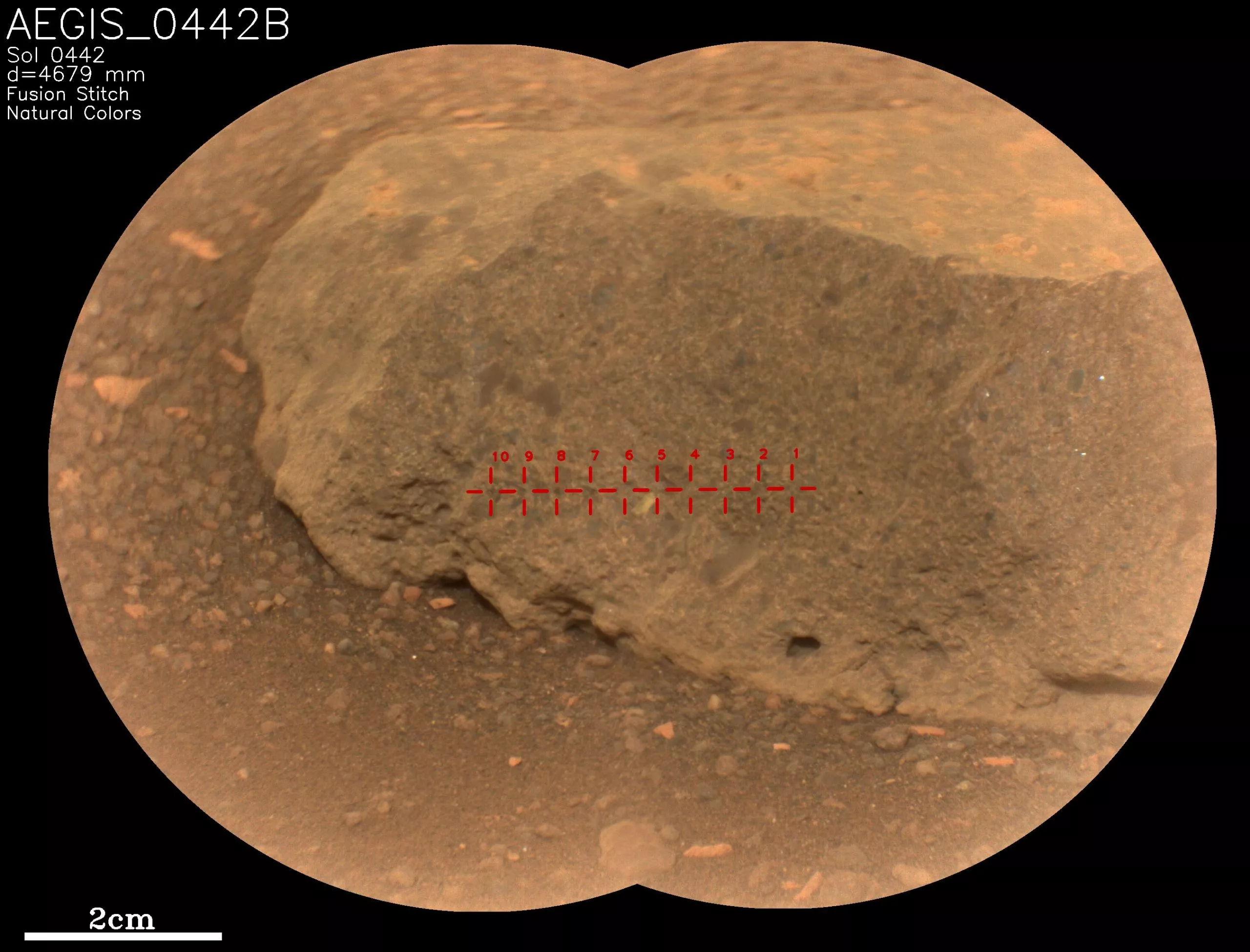
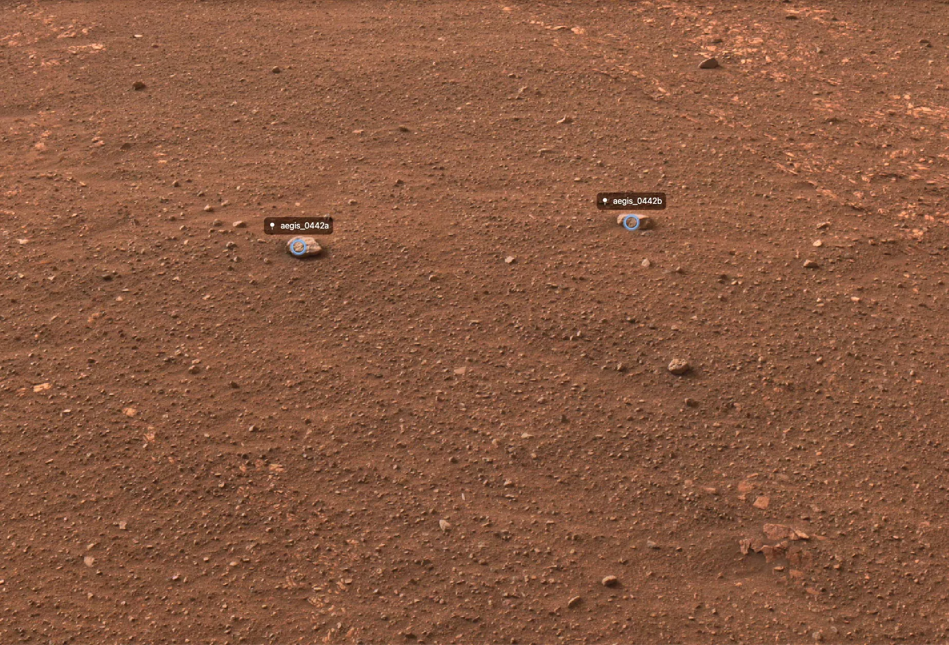
Aegis test on the "perseverance" began in March, which is carried out by collecting images of the supercam remote micro imager (RMI), but does not emit laser. Aegis first used the laser last week after adjusting several parameters in continuous tests. The attached image shows the selected and photographed rocks. RMI images were taken after laser shooting to show the emission position of the laser. The perseverance team plans to frequently use aegis from now on to provide faster data on the composition of rocks around the rover path.