For the first time, researchers have discovered groundwater under Antarctic ice. The discovery confirms what scientists have suspected but have not been able to verify until now Scientists need data from all parts of the Antarctic ice sheet to understand how the system works and how it changes in response to climate over time.
The study revealed a previously inaccessible and unexplored part of the Antarctic ice sheet and improved scientists' understanding of its possible impact on sea levels.
Chloe Gustafson, a postdoctoral researcher at the Scripps Institute of oceanography at the University of California, San Diego, said: "ice streams are very important because they transport about 90% of the ice in Antarctica from the inside to the edge. The groundwater at the bottom of these ice streams can affect their flow patterns, which may affect the transportation patterns of ice on the Antarctic continent."
There's a lot of ice imaging in Antarctica, but there's only one team. "This suggests that there may be groundwater beneath more Antarctic ice streams," Gustafson said
A team of scientists from Scripps Oceanography and Columbia University's Lamont Doherty Earth Observatory led the project. Gustafson and six collaborators reported their findings in science on May 6, 2022.
Helen Amanda Fricker, co-author of the study, Scripps glaciologist and co director of the Scripps polar center, said: "from our understanding of how the earth works, it has always been a hypothesis that there is groundwater under Antarctica, but we have been unable to measure it before."
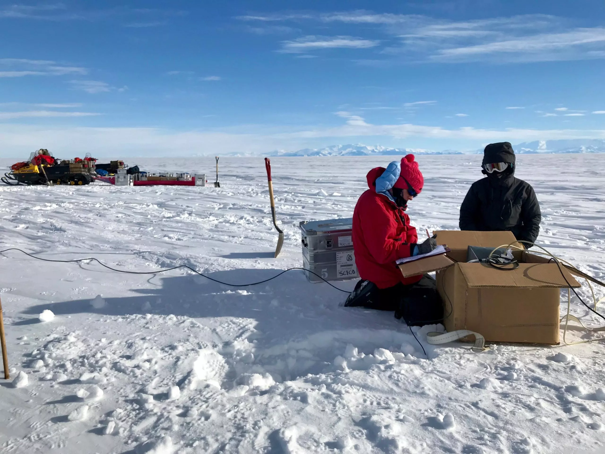
The researchers measured groundwater during the field season of 2018-2019 by using a ground geophysical electromagnetic (EM) method called magnetoelectric method. This method uses the changes of the earth's electric and magnetic fields to measure the underground resistivity. This study is the first to use this method to find groundwater under glaciers.
"This technology is usually not used in polar environments. This is a good proof of the power of this technology and how much it can bring us not only about Antarctica, but also about Greenland and other glacial areas," Fricker said
The technology has been used in Antarctica since the 1990s, but those studies are aimed at imaging deep crustal features at depths well below 10 kilometers. However, these studies do have the effect of proving that scientists can also use magnetic remote sensing technology on ice and snow.
Gustafson said: "we took their example and applied it to a shallow hydrological problem in a 5 km subglacial environment."
Over the past decade, airborne electromagnetic technology has been used to image some thin glaciers and shallow groundwater 100 to 200 meters below the permafrost in the McMurdo Dry Valley. But these technologies can only see through about 350 meters of ice.
The Whelan glacier, which Gustafson and his colleagues collected data, is about 800 meters thick. Their new data fills a huge gap between the previous deep and shallow data sets.
Kerry key, an associate professor of earth and Environmental Sciences at Columbia University and an alumnus of Scripps Department of Oceanography, said: "we imaged from the ice bed to about five kilometers or more."
"My hope is that electromagnetism will begin to be seen as part of the standard Antarctic geophysical toolbox," Gustafson said.
It is understood that this new research is based on passively collected and naturally generated magnetoelectric signals to measure the change of resistivity.
Gustafson said that since fresh water will show a great difference from salt water in their imaging, it is equivalent to telling them about the characteristics of groundwater.
The seismic imaging data provided by Paul WinBerry, a collaborator of shengton University in China, enhances the effect of electromagnetic measurement. These data confirm the presence of heavy sediments buried under ice and snow within 60 miles between the field team's magnetoelectric measurements.
The researchers calculated that if they could squeeze groundwater from sediments to the surface, it would form a lake with a depth of 220 to 820 meters.
Key pointed out that groundwater may exist under similar conditions of other planets or satellites, and they are releasing heat from their interior. "You can think of something that's completely liquid or icy inside Antarctica, whether you think it's a liquid covered moon or something like Europa."
In addition, the presence of groundwater under glaciers also has an impact on the release of large amounts of carbon previously stored by microbial communities adapted to seawater.
"Groundwater movement means that more carbon may be transported to the ocean than we thought before," Gustafson said.